Browse categories
Explore
Fiverr Pro
English
$
USD


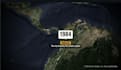

I create clean, engaging map animations and motion-graphics sequences for documentaries, educational videos, research stories, explainer videos, news-style content and YouTube productions.
A good map sequence does more than show a location. It gives the viewer context: where something happened, how a journey unfolded, how a landscape changed, or why a place matters.
I can create:
My geospatial background means I can work carefully with real places, coordinate data, boundaries and map context not just decorative animations.
Please contact me before ordering with your script, narration, locations, reference style, preferred aspect ratio and target duration.
Geospatial Software Engineer I GeoAI, WebGIS, Spatial Data Science
Languages
Can you animate a real route or research location?
Yes. Send the locations, route coordinates, KML/GeoJSON where available, or a clear written brief.
Can you edit my full documentary?
This gig focuses on map-animation sequences. Full documentary editing can be discussed as a custom offer.
Do you provide music or voice-over?
I can work with your licensed narration and music. Music licensing should be agreed before production.
Can you create vertical videos?
Yes. Specify whether you need 16:9, 9:16 or 1:1 before work begins.


