Browse categories
Explore
Fiverr Pro
English
$
USD

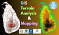


I WILL PERFORM PROFESSIONAL TERRAIN ANALYSIS AND 3D MAPPING USING QGIS
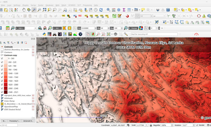
Unlock the power of your landscape with expert terrain analysis and GIS mapping services. I specialize in transforming elevation data into actionable insights using QGIS and Google Earth Engine for engineering, environmental, and planning projects.
I WORK WITH THESE DATA TYPES:
MY TERRAIN ANALYSIS SERVICES:
YOU WILL RECEIVE:
Message me before placing order to discuss your project
GIS and Remote Sensing Specialist
Languages
What elevation data do you use, and can I provide my own?
I typically use high-resolution global DEMs like AW3D30, SRTM, or Copernicus. For higher accuracy, I strongly recommend and can work with LiDAR or local survey data if you have it. Please message me about your project's precision requirements.
What specific deliverables will I receive?
You will receive high-resolution map images (PDF/PNG) and the processed raster data (GeoTIFF) for your future use. Higher packages include analysis reports and presentation slides. All files are delivered in ready-to-use formats.
Can you perform a watershed analysis for my specific location?
Yes, watershed delineation is a core service. I need your area of interest and the desired pour point location. I can help determine this if you're unsure. This is included in the Standard and Premium packages.
What's the difference between slope, aspect, and hillshade analysis?
Slope: Shows steepness (crucial for construction) Aspect: Indicates direction terrain faces (for solar/wind analysis) Hillshade: Provides 3D visualization of topography I'll recommend the right analysis based on your project goals.
Do you provide the source code or methodology for the analysis?
While I don't typically provide proprietary scripts, I deliver a complete methodology description and all output data. This ensures you can understand, replicate, and apply the results in your work effectively.