g
gis__expert

Khalid Dawar

@gis__expert

GIS and Remote Sensing Specialist

Afghanistan
English
About me
Hello! I am a GIS and Remote Sensing specialist with a strong background in geology and mapping. I have experience in creating different types of maps such as: NDVI, NDWI, and land use/land cover (LULC) maps Site plan and survey maps Data analysis using ArcMap and QGIS tools I am passionate about delivering accurate and high-quality work. I always try my best to complete projects on time and meet client expectations. If you are looking for a reliable and hardworking person, I am here to help you. Thank you!... Read more

Skills

g
gis__expert
Khalid Dawar
Offline • 
Average response time: 1 hour

See my services

Graphics & Design
I will create professional gis maps and other analysis
Geographic Information Systems (GIS)
I will create professional gis maps using arcgis and qgis

Portfolio

Work experience

People_Per Hour

GIS Analyst

People Per Hour • Self-employed

Dec 2021 - Dec 20243 yrs

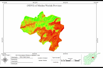
I am a GIS Analyst with experience in remote sensing and spatial analysis. I have worked on academic and freelance projects, including creating LULC maps, NDVI and NDWI analysis, and site planning using ArcMap. I focus on accuracy, quality, and timely delivery of projects.