Browse categories
Explore
Fiverr Pro
English
$
USD

GIS Specialist, GeoAI Specialist, Data Analyst
Skills
See my services

GIS Specilaist
Geo • Freelance
Apr 2019 - Present • 7 yrs 3 mos
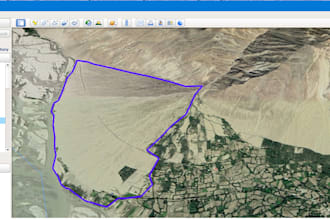
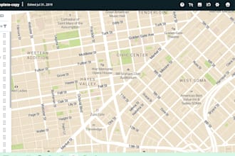
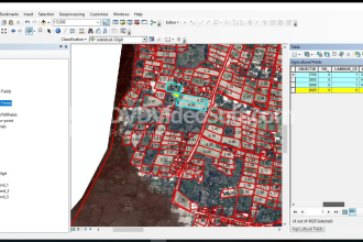
• Monitor GIS mapping activities. • Monitor the GIS Associate work and Performance Evaluation of GIS Associate. • Ensure that end users are provided with relevant GIS based maps and reports. • Assist in capacity development activities for Agriculture officials in the area of GIS. • Design and organize training courses for department’s technical staff on GIS and RS. • Promote research on different relevant thematic areas with integration of GIS/RS to fill the data gaps to support effective decision making. • Collection of data related to Agriculture and livestock to development of Geo-Database from the automated Farmer facilitation System (FFS). • Acquisition of Data from Fisheries Department for construction of GIS Maps, Database. • Report presentation in National and International workshops. • Present the result of GIS activities in Departmental and Research forum. • Concept Paper and PC-I preparation and paper Publications and presentation related to Agriculture, Livestock & Fisheries Department in national and international conferences and workshops. • Complex satellite GIS Data analysis from open source data (Landsat, Sentinel, MODIS and SPOT data)
| (15) | ||
| (2) | ||
| (2) | ||
| (0) | ||
| (0) |

noah_redford

United States
Difficult to communicate with. Didn’t seem willing to go above and beyond, but he did respond quickly.
Seller's Response

simonjusticehal
United States
navy
United States
Great seller and turned around the work super fast! Went above and beyond!
Seller's Response
ba6426

Germany
Seller's Response

vanessacole
Repeat Client
United States