Browse categories
Explore
Fiverr Pro
English
$
USD


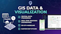
Welcome to Geon's WebGIS Hub!
Are you looking to transform complex geospatial data into interactive, responsive, and high-performance web maps? Look no further!
I am a professional WebGIS and Geospatial Developer. I specialize in building modern web mapping applications tailored to your business needs, ensuring smooth user experiences and robust data visualization.
What I Can Do For You:
My Tech Stack:
Why Work With Me?
PLEASE NOTE: Every GIS project is unique. Please contact me and send your requirements
Please be aware that it is against Fiverr's policies for sellers to include themes, templates, or any other elements that infringe third-party rights or applicable laws in the delivered work. Read more about in our Guide to Responsible Digital Creation.
WebGIS Developer
Languages
What geospatial data formats do I need to provide?
You can provide your spatial data in formats like GeoJSON, Shapefile (zipped SHP), KML/KMZ, CSV (with latitude/longitude), or give me access to your PostGIS database. If you don't have the data ready, I can help you find open-source geospatial data or generate sample data for your project.
Which mapping library should I choose for my project (Mapbox, Leaflet, or Cesium)?
It depends on your project requirements. Leaflet is excellent for lightweight, fast, and simple 2D maps. Mapbox GL JS is perfect for highly customized, modern, and high-performance 2D/3D vector maps. Cesium.js is the best choice for heavy 3D terrain visualization, BIM integration, and smart city app
Do I need to pay for Mapbox or Google Maps API keys?
You will need to register a free account on Mapbox or Google Cloud to get your own API key/access token so you retain full control over your app. Don't worry—most providers offer a very generous free tier (e.g., Mapbox offers up to 50,000 free map loads per month), which is usually more than enough
Can you integrate the web map into my existing website?
Yes, absolutely! I can build the WebGIS application as a standalone platform or seamlessly integrate it into your existing website, whether it's built with React, Vue, vanilla HTML/JS, or even WordPress. Please message me to discuss your current tech stack before placing an order.


