Browse categories
Explore
Fiverr Pro
English
$
USD

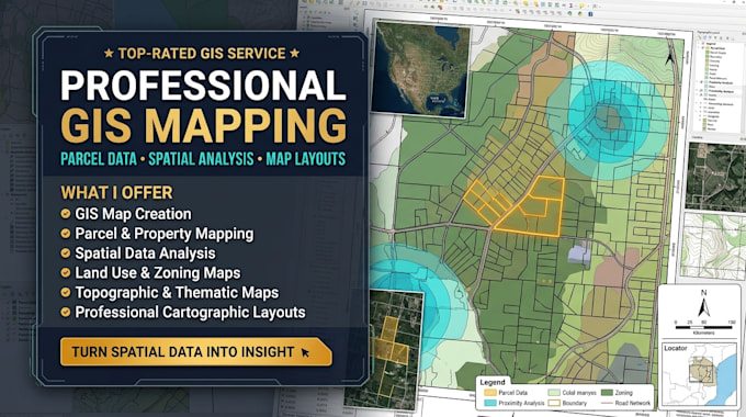
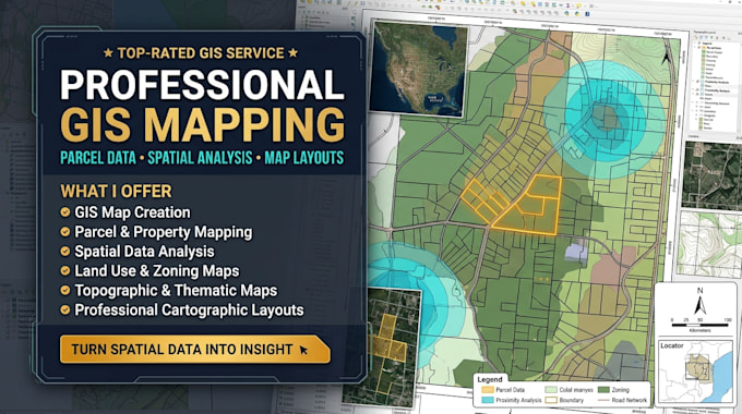
Are you looking for accurate GIS mapping, urban planning maps, or land parcel mapping using ArcMap? I can help you transform geographic data into clear, detailed, and visually appealing maps for planning, analysis, and presentation.
WHAT I OFFER
WHY CHOOSE ME
I focus on delivering organized, readable, and professional GIS maps tailored to your project requirements. I pay attention to map accuracy, layer arrangement, symbols, labels, legends, and overall presentation. Whether you need a simple overview map or a detailed land parcel map, I will work with your available geographic data and instructions.
Contact me today to discuss your GIS mapping, urban planning, or land parcel mapping project using ArcMap!
Map Illustration, Vector Maps, Tourism Maps, Event Maps
Languages
What types of GIS mapping services do you provide?
I provide GIS mapping, urban planning maps, land parcel mapping, land use mapping, zoning maps, thematic maps, and geographic data visualization using ArcMap.
What files do I need to provide for my GIS project?
You can provide shapefiles, geodatabases, CSV files, Excel data, coordinates, satellite imagery, KML/KMZ files, or other available geographic data. If you have a reference map, you can share it too.
Can you create land parcel and urban planning maps?
Yes, I can help create land parcel maps, property boundary maps, zoning maps, and urban planning maps based on the data and project requirements you provide.
Which file formats will I receive after completion?
Depending on your package, I can provide map exports in PDF, PNG, or JPEG formats, along with available GIS project files and supporting data when requested.
Can you customize the map to my specific requirements?
Yes, I can customize map colors, symbols, labels, legends, scale bars, north arrows, layouts, and map layers according to your instructions and the available data.