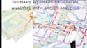
I provide professional GIS mapping, georeferencing, and spatial analysis services for environmental, engineering, planning, agriculture, and research projects. Every solution is tailored to your project requirements using industry-standard GIS tools.
Services
- Thematic and topographic maps
- Custom map design and visualization
- 3D terrain modeling
- Spatial analysis and interpolation
- Land suitability analysis
- Network and route analysis
- Satellite and aerial imagery analysis
- Land use and land cover classification
- NDVI and vegetation analysis
- Change detection
- Georeferencing scanned maps
- Feature digitization
- Raster to vector conversion
- Hydrological and watershed analysis
- Soil and agricultural mapping
- Climate and disaster risk mapping
- Site selection analysis
- Infrastructure planning
- Data conversion (KML, SHP, GeoJSON, CSV)
Software
- ArcGIS
- ArcGIS Pro
- QGIS
- Google Earth Pro
Please contact me before placing an order to discuss your project requirements, data, and expected deliverables.