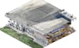
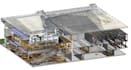
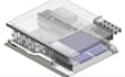
I will build 3d terrain model from point cloud,lidar scan processing,3d topographic map

H
holarib
H
holarib
Holarib

About this gig

Hello there

You are welcome here


I'm holarib, A Professional BIM and 3D architectural modeling specialized in Point Cloud to BIM conversion, transforming scanned data into precise 2D Floor Plans, 3D Revit Models, Elevations, and Sections. I deliver detailed, well-organized architectural models for building renovation, reconstruction, space planning, surveying, and engineering projects.


My Services Includes:

  • Point Cloud to Revit (Scan to BIM)
  • Accurate 3D Revit Models (LOD 200 / 300 / 350)
  • 2D Floor Plans, Sections & Elevations
  • Architectural & Structural Modeling
  • As-Built Revit Models
  • Conversion from LAS / LAZ / RCP / E57 files
  • Clash-free and well-organized Revit files


Here I Will build 3d terrain model from point cloud, lidar scan processing, 3D topographic map, Kindly contact me to discuss about your project requirement

Service verification and delivery style preference

Fiverr does not screen freelancers in this category. Please verify qualifications and discuss requirements with the freelancer before ordering, including any preferences regarding the use of AI tools.

Get to know Holarib

Holarib

Professional Architecture Point cloud, 3D Revit BIM modeler

  • FromColombia
  • Member sinceOct 2026
  • Languages

    English, French, Spanish, German
I'm Holarib, A Professional Architectural Point cloud, 3D Revit BIM modeler with 2+ years of experience in converting point cloud data into accurate 2D CAD drawings for clients in the US and EU. Skilled in producing floor plans, elevations, sections, site plans, and construction documentation. Experienced in facade detailing, layout, and quantity estimation for a Germany-based client, as well as construction drawings, architectural design, rendering, and millwork drafting for local and international independent contractors. Focused on accuracy, efficiency, and high-quality deliverables!