Browse categories
Explore
Fiverr Pro
English
$
USD

Welcome to your specialized WebGIS Development Service!
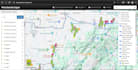
Are you looking to visualize your spatial data effectively or build a robust mapping application? You found the right place. I am a GIS Developer with expertise in transforming complex geospatial data into user-friendly, interactive web maps.
Whether you need a simple store locator or a complex geospatial dashboard for environmental monitoring, real-estate, or urban planning, I can help you achieve your goals.
What I Can Do For You:
My Tech Stack:
Why Choose Me?
Please contact me before placing an order to discuss your specific requirements and get a custom quote.
Please be aware that it is against Fiverr's policies for sellers to include themes, templates, or any other elements that infringe third-party rights or applicable laws in the delivered work. Read more about in our Guide to Responsible Digital Creation.
Languages
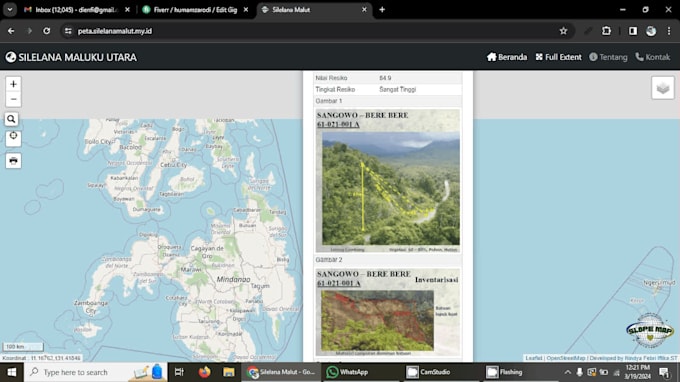
What is GIS?
GIS is science that encapsulate Location data collection, data manipulation, and data visualisations. It can help in making decision making faster, better, and flexible.
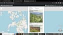
Can the maps be integrated into my current website?
Yes, GIS Web Maps can be integrated into current website, and they can act as standalone application too.
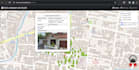
I have addresses, how can we show them on map?
In order to display the data on the map, you need latitude and longitude information, if you have addresses of data and want them to be displayed in an application, addresses needs to be converted into Latitude and Longitude Information. We have extensive experience with that, and we can convert the
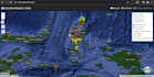
Can the map be interactive e.g. zoom in/zoom out, pan around.
Yes.
Can I make it online?
Yes, you can. You need to deploy it to your hosting server. If you want to do it, I will assist you.
Can i use the maps offline?
Yes, you can have offline display of your maps too.
What do I need to get started?
I need your spatial data (Shapefile, GeoJSON, KML, or Excel with coordinates) and a brief description of the features you want on the map.
Do you provide hosting?
I don't provide hosting, but I can help you upload your WebGIS application to the server of your choice.