Browse categories
Explore
Fiverr Pro
English
$
USD

GIS Remote Sensing Specialist, Soil Survey Analyst for Agriculture and Forestry
Skills
See my services

Confidentials
Full-time • 8 yrs 2 mos
Soil Mapping Assistant - Research and Development Officer
Nov 2024 - Mar 2026 • 1 yr 4 mos
•Led detailed soil data collection across ~5,000 hectares/month with a 3-person survey team, each supervising 2–3 field workers, maintaining consistent data quality across a large distributed operation. •Managed and cleaned field-collected soil data, converting it into Soil Management Unit (SMU) maps used directly by operations teams for fertilization and land management decisions. •Verified field data through ground checks in marginal/poor-growth areas, ensuring the dataset behind operational recommendations was accurate before it reached decision-makers. •Developed and rolled out a mobile data-collection tool (Google AppScript + Google Sites) to digitize tally sheets, removing manual paper-based data entry, cutting related admin workload, and reducing stationery costs. •Wrote SOPs and trained field plantation teams on survey and data-collection methodology
Environtmental Consultant - Soil Analyst & Mapper
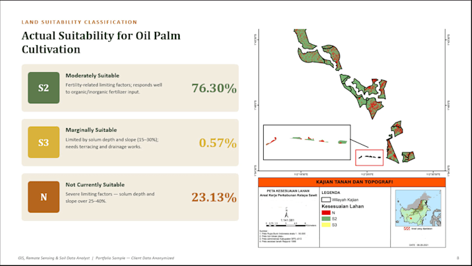
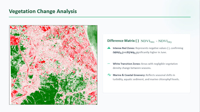
Dec 2017 - Oct 2024 • 6 yrs 10 mos
Delivered soil surveys, land evaluation, GIS analysis, and environmental assessments for forestry, plantation, peatland, and agricultural development projects across Sumatra, Kalimantan, Papua, and Java. Conducted detailed field investigations covering more than 30,000 hectares, collecting soil morphology, topographic, peatland, and land capability data in accordance with national and international survey standards. Produced spatial datasets and technical maps using ArcGIS, QGIS, GPS, satellite imagery, and remote sensing, supporting land-use planning, plantation development, environmental impact assessments, and operational decision-making. Performed Land Suitability Assessment (FAO Framework), Soil Mapping Unit (SMU) delineation, and topographic analysis for plantation and agricultural development projects. Participated in High Conservation Value (HCV/HCS) baseline studies by providing soil, terrain, and land capability analyses used during environmental planning. Collected peat ecosystem data for carbon certification projects (VCS & CCB), including large-scale expeditions in primary peat forests to support carbon stock verification and ecosystem assessments. Managed field survey logistics, coordinated multidisciplinary survey teams, and ensured data quality through field verification, GPS validation, and standardized survey protocols. Prepared technical reports, thematic maps, spatial databases, and recommendations for government agencies, environmental consultants, and private-sector clients. Worked directly with clients, local communities, government stakeholders, and multidisciplinary experts to ensure environmental data met project objectives and reporting standards.
