Browse categories
Explore
Fiverr Pro
English
$
USD
Need a Civil 3D grading plan for your site?
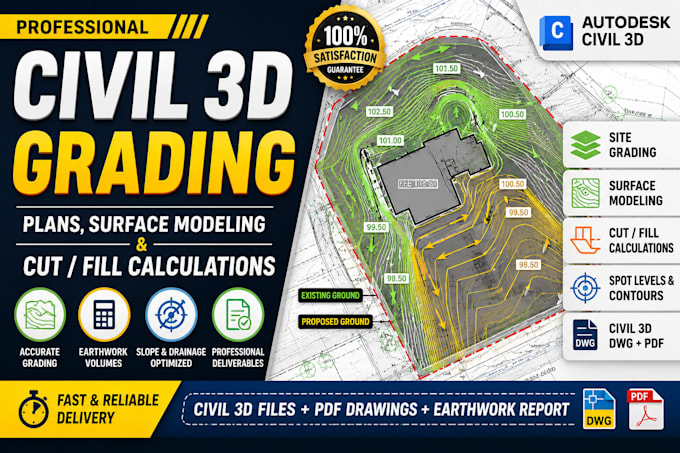
I will create site grading plans, Civil 3D surfaces, proposed elevations, contours, feature lines and cut/fill calculations from your survey and design information.
My service can include:
I work from survey data, point files, existing drawings, proposed elevations or other project information you provide. Suitable for residential, commercial and land-development projects.
Engineering approval, stamping or permitting by a locally licensed professional is not included unless specifically agreed.
Contact Me Before Ordering so I can review your files, confirm the scope, recommend the right package and provide an accurate delivery time.
Send your survey/DWG/PDF and requirements, and let's create a practical grading solution.
Project scale:
Building
Building type:
Residential
•
Industrial
•
Infrastructure
Material speciality:
Concrete
•
Wood
Please inform the freelancer of any preferences or concerns regarding the use of AI tools in the completion and/or delivery of your order.
What files do you need to start?
I normally need a survey, topographic information, existing DWG/PDF, proposed elevations or design information, and the site boundary. If you don't have everything, contact me first and I can review what you have.
Can you calculate cut and fill quantities?
Yes. Depending on the package and available data, I can create existing and proposed surfaces and calculate cut/fill or earthwork quantities using Civil 3D.
Can you work with an existing Civil 3D project?
Yes. You can provide your existing Civil 3D DWG/project files, and I can work with the available surfaces, points, alignments, feature lines and design information according to the agreed scope.
