Browse categories
Explore
Fiverr Pro
English
$
USD

GIS and Terrain Modeling Specialist
Skills
See my services
Self Employed
Self-employed • 9 yrs 10 mos
GIS & Cartography Specialist | Topographic & Vector Mapping Expert
Jan 2022 - Present • 4 yrs 6 mos
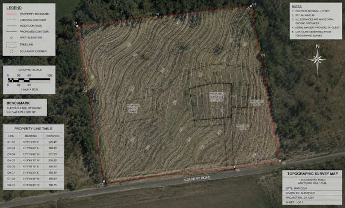
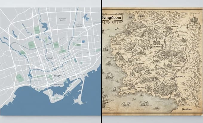
I'm a professional GIS and cartography specialist with expertise in creating high-quality city maps, topographic maps, contour maps, and terrain models for engineering, architecture, urban planning, and real estate projects. My work involves transforming raw survey data and geospatial information into accurate, visually clear, and technically precise maps using industry-standard tools such as AutoCAD Civil 3D and GIS software. I specialize in: • Custom City Map Design • Vector Map Illustration • Contour & Topographic Mapping • Civil 3D Site Plans • Terrain & Elevation Modeling • Survey Data Processing I focus on accuracy, clean design, and professional delivery that meets both technical and visual standards for clients worldwide.
Junior GIS Technician / Mapping Assistant
Mar 2021 - Present • 5 yrs 4 mos
Assisted in GIS and mapping projects involving spatial data digitization, contour generation, and vector map preparation. Worked on basic Civil 3D drafting tasks and supported senior engineers in converting survey data into usable mapping outputs. Gained practical experience in geospatial analysis, cartographic design, and technical drawing standards.
