Browse categories
Explore
Fiverr Pro
English
$
USD


Welcome to my professional drone data processing and agricultural GIS mapping service.
I provide high-precision data analysis using Pix4Dfields, DroneDeploy, QGIS, and AutoCAD. I transform raw UAV imagery into clean, actionable digital assets compatible with your machinery and flight controllers.
What I offer in this Gig:
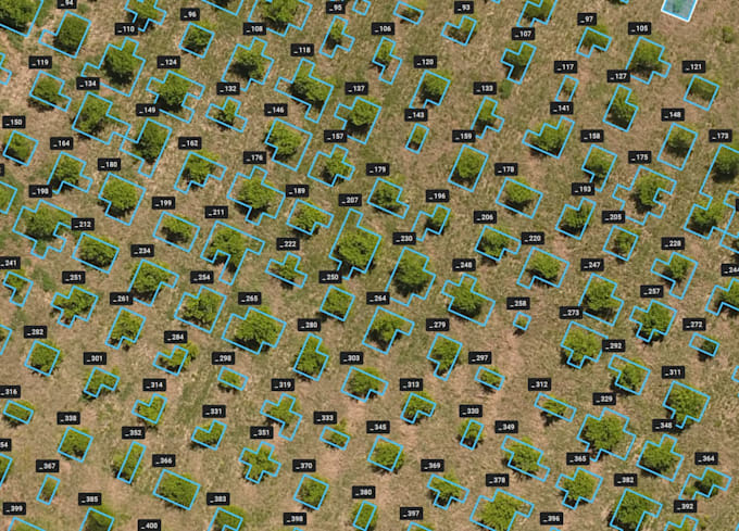
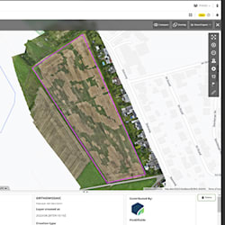
High-resolution orthomosaic generation from raw drone imagery.
Vegetation index mapping (NDVI, NDRE) to monitor crop health.
Precise digitization of field boundaries and accurate area calculations.
Multi-level zonation and prescription maps for variable rate application (VRA).
Mapping of physical obstacles, hazards, and custom no-spray buffer zones.
Deliverables:
I deliver clean data packages tailored to your requirements, including shapefiles (.SHP), .KML/.KMZ, and GeoTIFFs, ready for direct import into smart tractors, field machinery, or spraying drones (DJI, XAG).
Please contact me before placing an order to discuss your raw data formats and specific project requirements. Let's optimize your field management together!
Precision GIS mapping and operational drone data processing
Languages