Browse categories
Explore
Fiverr Pro
English
$
USD
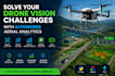
Drone Vision, Computer Vision Specialist Turning Aerial Data into Actionable
Are you collecting drone footage but struggling to turn it into useful information? I help businesses solve monitoring, inspection, surveillance, and analysis challenges using AI-powered drone vision solutions. Instead of manually reviewing hours of aerial footage, I create systems that automatically detect, track, count, and analyze objects of interest.
Whether you need construction progress monitoring, infrastructure inspection, traffic analysis, security surveillance, warehouse monitoring, agricultural assessment, or industrial site analytics, I deliver practical solutions tailored to your goals.
My services include aerial object detection, object tracking, vehicle counting, people counting, parking occupancy analysis, custom YOLO models, OpenCV development, and video analytics. Every project is designed to reduce manual work, improve accuracy, and provide actionable insights from your drone data.
If your challenge involves aerial imagery, drone footage, or automated monitoring, I can help transform raw data into valuable business intelligence.

Can you work with footage from any drone brand?
Yes. DJI, Autel, Parrot, Skydio, and most standard drone video formats are supported.
Can you analyze footage captured at different altitudes?
Yes. Models can be optimized for both low-altitude detailed inspections and high-altitude monitoring.
Can the solution generate reports automatically?
Yes. Depending on requirements, I can generate summaries, counts, statistics, and visual reports.


