Browse categories
Explore
Fiverr Pro
English
$
USD

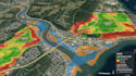
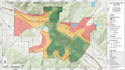
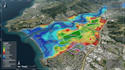
Need to know which locations are suitable, where development constraints exist, or which areas face higher geographic risk? I provide GIS site selection, land suitability, flood risk, and geographic mapping analysis based on your project criteria and available spatial data
I can analyze factors such as land use, elevation, slope, drainage, roads, proximity, environmental constraints, flood zones, infrastructure and other relevant geographic criteria. For multi-factor projects, GIS overlay, reclassification, proximity analysis, and suitability workflows can be used to compare locations and highlight priority areas
What I offer:
Please provide the location, boundary, GIS layers or reference data, analysis criteria, preferred output format & intended use.
Message me before ordering for complex site-selection models, large study areas, multiple datasets or advanced flood/hydrological analysis.
Illustrated Map Designer for Campgrounds and Tourism
Languages
Can you perform site selection using my own criteria?
Yes. Provide the criteria and available geographic data so the analysis can be structured around your project.
Can you perform land suitability analysis?
Yes. Suitability can be assessed using appropriate spatial criteria and overlay methods.
Can you create flood risk maps?
Yes, for GIS-based mapping and spatial-analysis projects where suitable data and methodology are available.
Can you combine several GIS layers?
Yes. Multiple spatial layers can be combined through overlay, proximity, reclassification and related GIS workflows.
Do I need to provide the GIS data?
You can provide your data, or we can first discuss what datasets are required for the project.
Can you work with ArcGIS or QGIS data?
Yes, depending on the project requirements and available files.
Can you analyze a specific property or area?
Yes. Provide the boundary, coordinates, parcel information or study-area reference.


