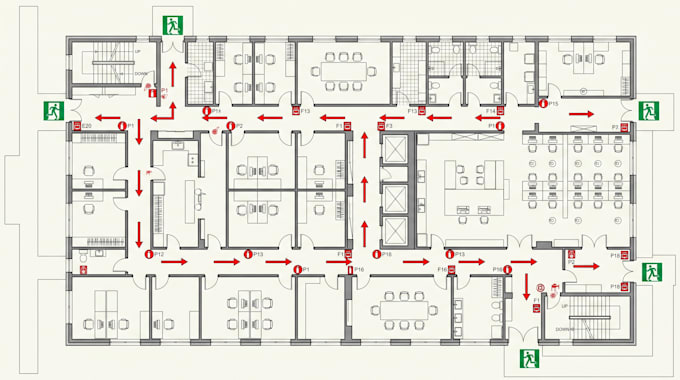
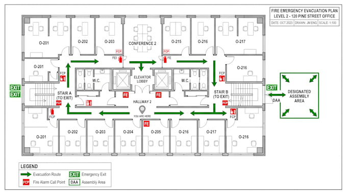
I will do fire emergency evacuation map plan, fire safety map diagram for property map

J
jorpartan
J
jorpartan
Jordan

About this gig

Need a professional Fire Emergency Evacuation Map, Fire Safety Map, or Emergency Floor Plan for your property?


I can create clear, accurate, and easy-to-follow evacuation maps designed to help occupants quickly identify emergency routes and safety equipment.


I can create:

  • Fire emergency evacuation maps
  • Fire safety floor plans
  • Emergency evacuation route maps
  • Property fire safety maps
  • Building evacuation plans
  • Floor-by-floor evacuation diagrams
  • Fire escape route plans
  • Assembly point/location maps
  • Fire extinguisher location plans
  • Fire alarm & emergency equipment maps
  • Exit and emergency door locations
  • You Are Here location markers
  • Stairway and corridor evacuation routes
  • Accessible evacuation routes
  • Office, apartment & residential maps
  • Hotel, school, warehouse & commercial maps
  • Site/property emergency maps
  • Clean PDF, PNG, JPG & print-ready layouts


I can work from existing floor plans, architectural drawings, sketches, property maps, PDFs, images, or provided dimensions and turn them into a clean, professional emergency map.


Clear layout. Easy navigation. Professional presentation.


Ready for printing, posting, or digital use.

Delivery style preference

Please inform the freelancer of any preferences or concerns regarding the use of AI tools in the completion and/or delivery of your order.

Get to know Jordan

Jordan

Map Pro

  • FromUnited States
  • Member sinceSep 2026
  • Languages

    English
I’m a Mapping Specialist helping clients turn location data, plans, drawings, and geographic information into clear, accurate, and professional maps. I create custom GIS maps, site maps, property and parcel maps, zoning maps, land-use maps, location maps, route maps, and other technical mapping solutions tailored to your project. I can also handle GIS data processing, digitization, georeferencing, CAD-to-GIS conversion, spatial analysis, and map visualization. Send me your data, drawing, coordinates or project requirements and I’ll turn them into a professional map you can confidently use.