Browse categories
Explore
Fiverr Pro
English
$
USD


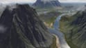

Need a 3D terrain model from a heightmap, elevation data or reference?
I will create a terrain mesh for visualization, presentation, landscape concepts or compatible 3D workflows.I can design the model to your intended use, whether it is a 3D presentation, a terrain study, a physical terrain print or a visualization project.
Terrain modeling services:
Why Choose Me?
Let's turn your terrain data or reference into a useful 3D model. Please contact me before ordering with your source data, intended use, scale, model dimensions and preferred file format!!!!
Please inform the freelancer of any preferences or concerns regarding the use of AI tools in the completion and/or delivery of your order.
3d terrain expert
Languages
Can you create a model from a heightmap?
Yes, if the source format is suitable.
Can you create an STL terrain for 3D printing?
Yes, if the model can be prepared for the intended print dimensions and process.
Can you use geographic elevation data?
Yes, subject to data availability and format compatibility.
Can you supply OBJ files?
Yes, if suitable for the model and agreed before ordering.
Can you match a specific scale?
Yes, if the dimensions and source data are provided.