Browse categories
Explore
Fiverr Pro
English
$
USD

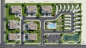
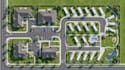
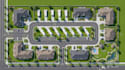
Looking for a clear, professional and visually appealing map for your property, land or development project? I can help.
I will create a custom illustrated plot, plat, RV parking, site or property map based on your requirements and reference information.
My services can include:
I focus on creating maps that are organized, easy to understand and professionally presented for presentations, websites, marketing materials, property information, visitors and planning purposes.
Why choose me?
Send me your property information, sketch, reference image or requirements, and let's turn it into a professional custom map.
Message me before ordering if your project has special requirements. I will be happy to discuss the best approach for your map.
Please inform the freelancer of any preferences or concerns regarding the use of AI tools in the completion and/or delivery of your order.
Custom Maps, Site Plans and Visual Mapping
Languages
Can you create a map from a sketch?
Yes. You can provide a hand-drawn sketch, existing map, satellite image or other reference, and I can use it as the basis for the illustration.
Can you design RV parking maps?
Yes. I can illustrate RV parking spaces, roads, entrances, amenities, buildings, landscaping and other relevant features.
Can you create a property map from a satellite image?
Yes. A satellite image can be used as a visual reference for creating a customized property map.
Can you create a plot or plat map?
Yes. I can create a clean illustrated representation based on the information and references you provide.
Can you add labels and a legend?
Yes. I can add customized labels, symbols, directional indicators and a map legend where required.
Will I receive a source file?
Source files can be included depending on the package you select. Please message me before ordering if you require a specific editable format.
Can you work with large properties?
Yes. Larger or more complex properties can be handled as custom orders. Send me your requirements so I can determine the appropriate scope.
Can you make the map look illustrated rather than technical?
Yes. I can create different visual styles, from clean professional site-plan layouts to more attractive illustrated property maps.


