Browse categories
Explore
Fiverr Pro
English
$
USD

Level 1



Experienced Geospatial Analyst with expertise in ArcGIS, QGIS, remote sensing, and spatial data management. I provide professional GIS mapping and digitization services for government projects, research, planning, business analysis, and academic applications. My experience includes working with large-scale administrative datasets, census integration, routing networks, and enterprise GIS solutions with high spatial accuracy.
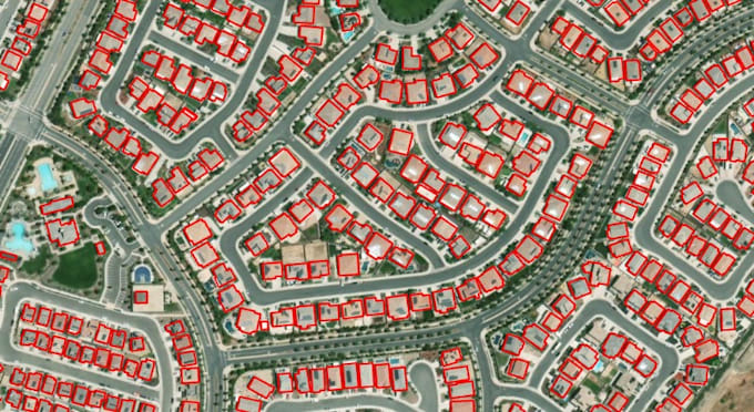
I create and digitize all types of administrative and thematic maps using official boundary and census datasets.
Services Include:
India, State, District, Subdistrict, Town & Village bnd
Ward, Assembly & Parliamentary Constituency bnd
Historical Boundary Maps & Census Integration
Custom GIS Layers & Thematic Mapping
Georeferencing, Topology Correction & Spatial Data Cleaning
Deliverables:
High-Resolution Maps (PNG, PDF, JPEG)
GIS Files (Shapefile, GeoJSON, KML)
Editable ArcGIS/QGIS Project Files
Professional Cartographic Layouts
Why Choose Me?
Research-based GIS workflow
Accurate and clean spatial data
Fast communication & on-time delivery
Reliable support for long-term projects
Please contact me before placing an order to discuss project requirement
GIS Expert
Level 1
Languages
Do you provide digitization from scanned maps or images?
Absolutely. I offer precise digitization services from scanned maps, PDFs, satellite imagery, or hand-drawn sketches. The final output will be clean, topology-checked, and spatially accurate GIS layers ready for analysis.
Do you offer georeferencing and map digitization services?
Yes. I provide precise georeferencing of scanned maps, satellite images, and PDF maps. I also digitize boundaries, land parcels, roads, and other spatial features into high-quality GIS vector layers.
What type of maps can you create?
I can create administrative maps at national, state, district, tehsil, town, and village levels across India. I also prepare historical boundary maps, census-based thematic maps, and fully customized GIS layers based on your specific research or project requirements.
Which formats will I receive after project completion?
You will receive high-resolution map outputs (PNG, PDF, JPEG,tiff) along with GIS data files such as Shapefile, GeoJSON, GeoPackage (.gpkg) or KML. If required, I can also provide the editable project file compatible with ArcGIS or QGIS for further modification.
Can you integrate census or government datasets into the maps?
Yes. I integrate official administrative and census datasets to generate accurate thematic maps suitable for academic research, policy analysis, government reporting, and planning studies. Data visualization can include population, literacy, demographics, and other statistical attributes.
Can you customize maps based on specific research objectives?
Yes. Every project is customized according to your analytical goals. Whether you need multi-scale administrative mapping, spatial analysis outputs, or cartographic layouts for publication, I ensure the final deliverables align with your research or institutional standards.
What software and data sources do you use for GIS projects?
I use ArcGIS, ArcGIS Pro, ArcGIS Enterprise, QGIS, Google Earth Pro, ENVI, SNAP, and MapInfo. Data sources include Census, LGD, satellite imagery, cadastral maps, Survey of India maps, OSM, and client-provided GIS datasets for accurate project delivery.