Browse categories
Explore
Fiverr Pro
English
$
USD

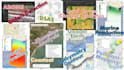


I provide professional GIS mapping and remote sensing services with a focus on marine and coastal environments. My work helps researchers, NGOs, consultants, and environmental agencies transform satellite and geospatial data into clear, accurate, and decision-ready insights. I specialize in marine GIS, coastal analysis, and satellite-based environmental monitoring using industry-standard tools and workflows.
Services I Offer
️Data & Platforms I Work With
Sentinel (1 & 2), Landsat, MODIS, Copernicus, NASA Earthdata, Drone Imagery, and Climate Datasets.
Tools include:
ArcGIS Pro, QGIS, Google Earth Engine, Python, CoastSat and DSAS.
Top Quality Work, 100 Percent Client Satisfaction, Professional Team
Languages
What do you need from me to start the project?
I need your study area location, project objective, preferred output type, and any available data (shapefiles, coordinates, or satellite images). If you don’t have data, I can guide or source it.
What GIS software do you use?
I work with industry-standard tools including ArcGIS Pro, QGIS, Google Earth Engine, ENVI, and remote sensing libraries for advanced analysis.
Can you handle coastal and marine environment projects specifically?
Yes, I specialize in coastal GIS and marine remote sensing, including shoreline change, erosion analysis, mangrove mapping, and marine spatial planning.
What type of outputs will I receive?
You will get high-resolution maps, GIS layers (shapefile, GeoJSON, raster), charts, and a detailed report depending on your package.
Can you use satellite imagery like Sentinel or Landsat?
Yes, I regularly use Sentinel-1, Sentinel-2, Landsat, and other open-source or provided satellite datasets for analysis.
Is your work suitable for academic or publication use?
Yes, all outputs are clean, accurate, and publication-ready, suitable for journals, theses, and reports.
How accurate is your analysis?
Accuracy depends on data quality, but I apply standard remote sensing validation and GIS best practices to ensure reliable results.
Do you offer revisions?
Yes, I include revisions to ensure the final output meets your project requirements.
How long does a typical project take?
Delivery time depends on complexity, but simple GIS tasks can be completed within 1–3 days, while advanced analysis may take longer.
Can you handle urgent or large-scale projects?
Yes, I can handle both urgent requests and large datasets, depending on scope and agreement.


