Browse categories
Explore
Fiverr Pro
English
$
USD



Static maps tell you where things are. Interactive maps tell you why they matter."
Are you looking to bridge the gap between complex GIS analysis and a user-friendly web interface? Youve found the right expert. With over 7 years of experience as a Spatial Software Engineer, I specialize in transforming raw data from QGIS and ArcGIS Pro into high-performance, interactive web applications that drive real-world decisions.
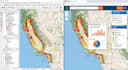
From developing the Interactive USA Wildfire Dashboard to managing over 40+ global projects, I know exactly how to handle large-scale spatial datasets while maintaining a clean, intuitive UI/UX.
What I bring to your project:
Lets turn your geospatial data into an interactive reality.
GIS Developer, Google Earth Engine, Python Automation, ArcGIS Pro
Languages
Can you convert my QGIS or ArcGIS Pro project to a web map?
Yes, absolutely! I specialize in converting desktop GIS projects (.qgz, .mxd, .aprx) into fully functional, high-performance interactive web maps using Leaflet, Mapbox, or OpenLayers. All your layers, symbology, and attributes will be preserved
Do I need to provide the hosting for the interactive map?
It depends on your requirements. I can provide the source code (HTML/JS/CSS) which you can host on any web server (GitHub Pages, Netlify, or your own hosting). If your project requires a database like PostGIS, I can guide you on the best hosting solutions.
Can you integrate real-time data like the USA Wildfire feeds?
Yes! I have extensive experience in integrating live API feeds from sources like NASA FIRMS, USGS, and MODIS/VIIRS. This allows your map to update automatically with the latest wildfire or environmental data.
Will the interactive map work on mobile devices?
Definitely. All the web maps and GIS dashboards I develop are fully responsive. They are optimized to work smoothly on desktops, tablets, and smartphones without losing functionality.


