Browse categories
Explore
Fiverr Pro
English
$
USD


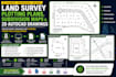
Need professional land survey drawings, subdivision maps, or accurate 2D AutoCAD plans for your project? You are in the right place. I deliver clean, precise, and professionally drafted survey plotting plans and CAD drawings for architects, engineers, surveyors, contractors, real estate developers, and permit applications.
I transform survey data, sketches, PDFs, and field measurements into accurate, high-quality technical drawings ready for planning, construction, and approvals.
My Services Include:
Why Choose Me?
Whether you need a simple property plot, subdivision layout, or detailed 2D AutoCAD drafting, I deliver accurate, reliable, and high-quality results that meet professional standards.
Please contact me before placing an order to discuss your project requirements, files, and expected deliverables.
Please inform the freelancer of any preferences or concerns regarding the use of AI tools in the completion and/or delivery of your order.
Professional Land Surveyor And CAD Drafting Expert
Languages
