Browse categories
Explore
Fiverr Pro
English
$
USD

Level 1
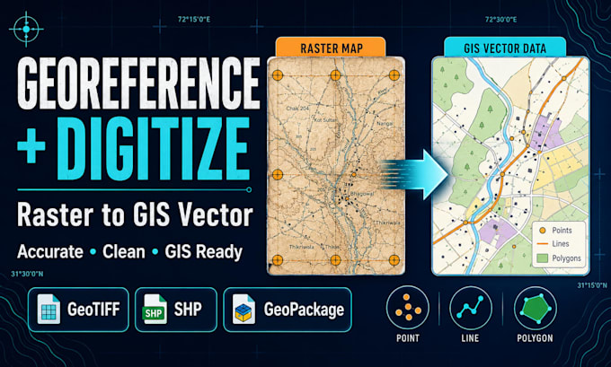
Do you have a scanned map, PDF, image, historical map, site plan, or satellite image that must be converted into accurate GIS data?
I will georeference your source and digitize visible features into clean point, line, or polygon layers using ArcGIS Pro or QGIS. Services may include
Depending on the package, you can receive a georeferenced GeoTIFF, SHP, GeoPackage, GeoJSON, KML, PDF map, or editable ArcGIS/QGIS project. Layers, fields, projections, and file structures will be clearly organized.
Accuracy depends on source quality and reliable control points. This service does not replace a licensed land survey or legal boundary determination.
Please contact me before ordering and send the source map, known coordinates or reference layer, required features, output formats, CRS, and deadline. Feature limits apply to simple objects. Dense cadastral, engineering, or historical maps may require a custom or hourly offer based on volume of work.
GIS, Spatial Analyst and Cartographer
Level 1
Languages
What types of maps can you georeference?
I can work with scanned paper maps, historical maps, PDF maps, site plans, aerial images, satellite images, screenshots and other raster sources when suitable reference information is available.
What information is required for georeferencing?
Useful information includes coordinate-grid labels or known latitude and longitude points, an existing reference layer (if available), the correct coordinate reference system etc.
Can you georeference a map without coordinates?
Sometimes. Clearly identifiable roads, buildings, rivers, coastlines or intersections may be matched against reliable reference data. Accuracy will depend on the source map and the availability of unchanged reference features.
Which features can you digitize?
I can digitize points, roads, rivers, boundaries, parcels, buildings, land-use zones, water bodies, administrative areas and other visible features.
What does one feature mean?
One location is one point, one road or river segment is one line, and one building, parcel or land-use area is one polygon. Highly detailed geometries may be priced separately.
Which output formats are available?
Available formats may include GeoTIFF, SHP, GeoPackage, GeoJSON, KML, CSV, file geodatabase, PNG, PDF and editable ArcGIS Pro or QGIS projects.
Will the vector layers include attributes?
Basic identifiers may be included where appropriate. Detailed attribute fields and data entry are included in selected packages or can be added as an extra.
Will you check the digitized data for errors?
Standard and Premium include basic geometry and topology checking. Premium includes more detailed checks for gaps, overlaps, duplicate features and layer organization.
Can you digitize cadastral or property boundaries?
Yes, visible boundaries can be traced for GIS visualization or data preparation. The output is not a legal cadastral survey and should not be used to establish ownership without verification by an authorized surveyor.
Should I contact you before ordering?
Always feel free to contact me any time. Either for small or big projects like dense maps, large feature counts, difficult historical maps, unclear projections, engineering drawings, several source sheets or urgent work.
