Browse categories
Explore
Fiverr Pro
English
$
USD


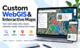
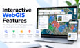
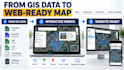


Need your GIS or location data turned into a fast, clear, interactive web map?
I build custom WebGIS and interactive web maps for businesses, real estate, research, NGOs, and project teams using Leaflet, Mapbox, OpenStreetMap, ArcGIS, and JavaScript.
MY SERVICES
WHAT YOU WILL RECEIVE
WHY CHOOSE ME?
Have a map idea or spatial dataset? Message me before ordering so I can recommend the right solution.
GIS Expert
Languages
What types of WebGIS and interactive maps can you build?
I can build business maps, real estate maps, store locators, project maps, service-area maps, route maps, dashboards, and other custom interactive web maps.
Which web mapping technologies do you use?
I work with Leaflet, Mapbox, OpenStreetMap, ArcGIS, JavaScript, GeoJSON, and related web mapping tools based on the project requirements.
Can you work with my existing GIS or location data?
Yes. I can work with shapefiles, GeoJSON, KML, CSV files, coordinates, spreadsheets, and other spatial data. I can also prepare data for web use when needed.
Can you add search, filters, popups, and layer controls?
Yes. Depending on your package, I can add location search, category filters, custom popups, clustering, legends, layer controls, and other interactive features.
Will my interactive web map work on mobile devices?
Yes. I build responsive web maps designed to work across desktop, tablet, and mobile screens, subject to the features and platform used.
Can you create a real estate map or store locator?
Yes. I can build real estate maps, property maps, branch or store locators, service-area maps, and other location-based business maps.
Can you integrate the map into my website?
Yes. I can prepare or integrate maps for HTML websites and suitable CMS or web platforms. Please share your platform before ordering so I can confirm the best approach.
Do you provide the source code?
Yes, source files can be included according to the selected package and project scope. Any third-party API keys, paid services, or licenses remain the client’s responsibility.
Can you connect APIs, live data, or a spatial database?
Yes, advanced projects can include API integration, live or external data, and database-connected WebGIS solutions. These are usually Standard, Premium, or custom-order projects.
What do you need from me before you start?
Please send your project goal, GIS or location data, required features, preferred style, reference examples if available, website platform, and deadline.


