Browse categories
Explore
Fiverr Pro
English
$
USD


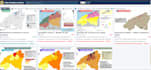
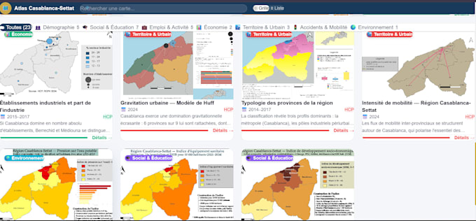
Are you looking for a custom interactive map or a geospatial web application? You're in the right place!
I am a GIS Engineering student specialized in geospatial development, remote sensing, and spatial data analysis. I combine GIS expertise with web development skills to deliver powerful and visually appealing map-based solutions.
What I offer:
Interactive maps with Leaflet.js (markers, popups, layers, filters)
GIS data processing and digitization with QGIS
Geospatial web apps with spatial queries
Map styling and custom tile layers
Integration of satellite imagery and spatial datasets
Why choose me:
⬡ GIS Engineering background (FST Tanger, Morocco)
⬡ Real project experience (UNESCO Hackathon Water Credit AI)
⬡ Clean, documented, and responsive code
⬡ Fast delivery and clear communication
Feel free to contact me before ordering to discuss your project!
Please be aware that it is against Fiverr's policies for sellers to include themes, templates, or any other elements that infringe third-party rights or applicable laws in the delivered work. Read more about in our Guide to Responsible Digital Creation.
Geoinformation Engineering Student
Languages
What data format do you need from me?
I accept GeoJSON, Shapefile, CSV with coordinates, KML, or any common GIS format.
Can you host the map online?
Yes, I can deploy the map on GitHub Pages or Netlify for free.
Do you work with real satellite imagery?
Yes, I can integrate Sentinel-2 or other satellite data depending on your needs.