Browse categories
Explore
Fiverr Pro
English
$
USD
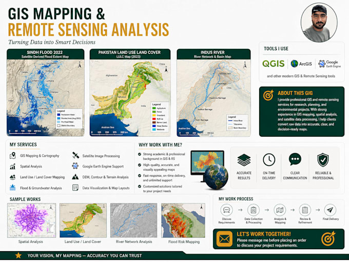
Hydrologist and GIS Remote Sensing Specialist
Skills
See my services

Research Assistant
University of Zurich • Full-time
Dec 2025 - Present • 7 mos
• Collect, compile, and integrate geographic data from various sources, including field observations, satellite imagery, aerial photographs, and existing maps. • Maintain and update GIS databases, ensuring data accuracy, quality, and integrity. • Perform spatial analyses and modeling to identify patterns, relationships, and trends. • Conduct hydrological modeling for different projects if required. Use hydrological data and models to predict flood events, droughts, and support different project activities. • Integrate hydrological models with GIS data to provide a comprehensive analysis for water resource management. • Create high-quality maps and other visual representations of geographic and hydrological data for reports, presentations, and publications.
