Browse categories
Explore
Fiverr Pro
English
$
USD
I help farms, agri-businesses, and researchers monitor crop health using free satellite data; no field sensors needed.
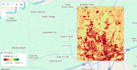
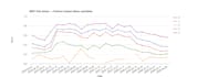
Using Google Earth Engine with Sentinel-2, MODIS, and ERA5-Land, I build vegetation health analysis using indices like NDVI, FAPAR, FVC, and ARI, turning raw satellite imagery into decision-ready insights for crop stress detection, irrigation gaps, yield risk flags, and farm-level advisory outputs.
I've built end-to-end systems for a precision agriculture company: from farm boundary detection (SAR + optical fusion, SAM-based segmentation) to crop health diagnostic dashboards feeding AI-based farm advisory platforms deployed for real projects.
What I can deliver:

Q: What input do you need from me?
A: I need your area of interest (AOI), desired time period, and which type of analysis you want (LULC, LST, change detection, or all).


