Browse categories
Explore
Fiverr Pro
English
$
USD

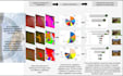


I provide professional GIS mapping, remote sensing, and spatial data analysis to turn geographic data and satellite imagery into clear, useful insights.
With 9 years of geospatial experience, I support projects involving thematic mapping, land-cover mapping, satellite imagery interpretation, change detection, spatial overlays, multi-layer analysis, and spatial data cleaning and preparation.
Depending on your needs, deliverables can include publication-ready maps, processed spatial datasets, concise technical summaries, and presentation slides that communicate findings clearly.
For remote sensing projects, I can source suitable, freely available satellite imagery where available and appropriate to the agreed scope.
Whether you need a single map or a more detailed spatial analysis, I aim to deliver accurate, well-presented, and practical geospatial outputs tailored to your objectives.
Please share your study area, project goals, available data, and desired outputs so we can agree on the most suitable scope before work begins.
GIS Remote Sensing Specialist
Languages
What information do you need to start my project?
Please provide your project objective, study area or boundary file, available data, preferred outputs, and any specific mapping requirements. For satellite imagery projects, include the dates or time period you want analyzed, if applicable.
Can you source satellite imagery for my project?
Yes. I can source suitable, freely available satellite imagery where available and appropriate to the agreed scope. Image availability, cloud cover, resolution, and historical coverage may affect feasibility. Commercial imagery and extensive preprocessing are not included unless separately agreed.
What types of GIS and remote sensing projects do you handle?
I work on thematic mapping, land-cover mapping, satellite imagery interpretation, change detection, spatial overlays, multi-layer analysis, digitization, and spatial data cleaning and preparation. Please contact me for specialized workflow so we can confirm the scope before the project begins.
Can you handle projects outside the listed packages?
Yes. Projects involving multiple study areas, additional imagery dates, extensive data preparation, or several analytical workflows may require a custom offer. Please contact me with your requirements so we can agree on the deliverables, cost, and timeline.
Do you provide presentations or technical summaries?
Yes. The Standard package includes a concise presentation slide of approximately 5–7 slides, while Premium includes a more comprehensive presentation of approximately 10–15 slides and a concise technical summary. Additional slides or separate presentations can be arranged as gig extras.
Does the service include field verification?
No, field verification is not automatically included. The reliability of the results depends on the input data, imagery resolution, analytical method, and available validation data. Any additional validation requirements must be discussed before ordering.
Can I request changes after delivery?
Yes. Each package includes the stated number of revisions for refinements to the agreed work, such as map labels, colours, legends, or layout. New study areas, additional analyses, or substantial changes to the original requirements may incur additional charges.
Can you deliver my project faster?
Extra-fast delivery may be available depending on the project scope, data readiness, and imagery availability. Please confirm feasibility with me before ordering a rush delivery, particularly for remote sensing or complex spatial analysis.


