Browse categories
Explore
Fiverr Pro
English
$
USD


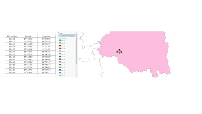
Do you have location data but dont know how to turn it into a professional map?
I will convert your Excel, CSV, GPS, or coordinate data into clean, accurate, and visually appealing GIS maps using ArcGIS Pro or QGIS.
What I offer:
Perfect for:
What you will receive:
I can also:
Send me your data and requirements I will handle everything professionally and quickly!
Please inform the freelancer of any preferences or concerns regarding the use of AI tools in the completion and/or delivery of your order.
Expert GIS Mapping, Orthophoto Processing Precision, Quality, Fast
Languages
What do you need from me to start the project?
Please provide your data in Excel, CSV, or any format with coordinates (Latitude/Longitude, DMS, or UTM). You can also share a sample or explain your requirements, and I will guide you.
Can you convert my coordinates to the correct format?
Yes, I can convert coordinates from DMS, UTM, or other formats into standard decimal degrees for accurate mapping.
What type of maps can you create?
I can create location maps, forest plot maps, land maps, survey maps, and custom GIS maps with labels, legends, and basemaps.
Will I get a high-quality file for reports or printing?
Yes, you will receive high-resolution PDF or PNG files suitable for reports, presentations, or printing.
Can you create multiple maps or combine datasets?
Yes, I can create multiple maps or combine different datasets into one map based on your requirements.
Do you provide editable files (ArcGIS/QGIS)?
Yes, I can provide editable ArcGIS Pro or QGIS project files upon request (included in the Premium package or available as an extra). If you only need the data, I can also deliver the geodatabase (GDB) file separately.