Browse categories
Explore
Fiverr Pro
English
$
USD

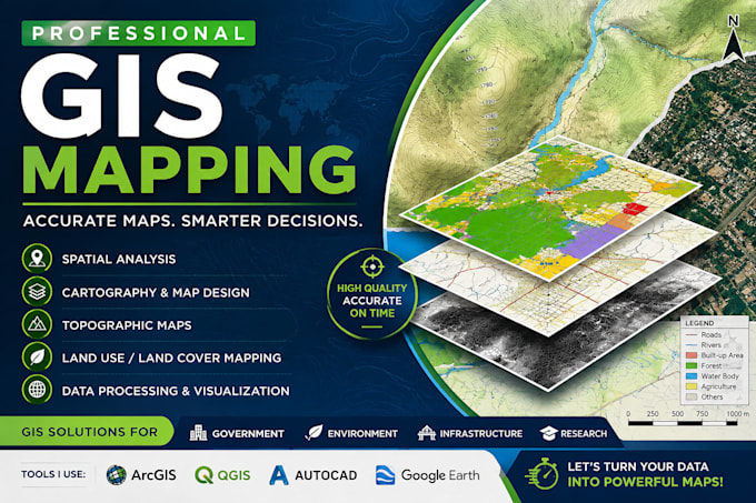
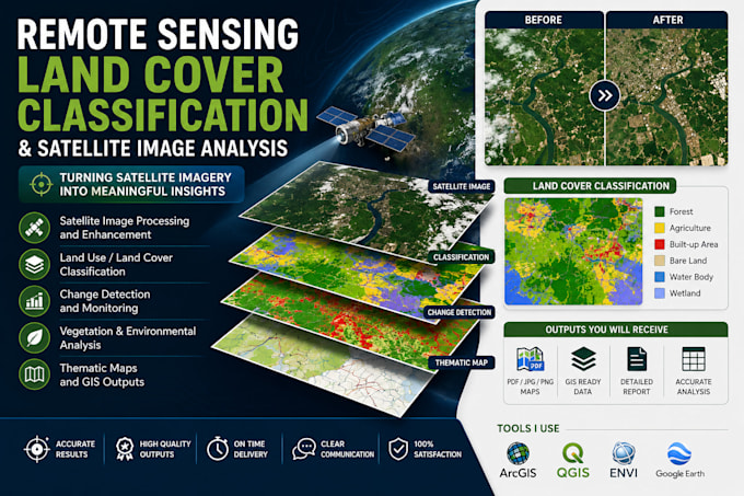
GIS Analyst AutoCAD Drafting Mapping and Spatial Analysis
Skills
See my services
Professional Land Surveyor
Freelancing Career • Self-employed
Sep 2024 - Present • 1 yr 10 mos
Provide surveying and GIS services including land subdivision, boundary mapping, georeferencing, spatial data collection, and topographic mapping. Produce thematic and topographic maps, maintain accurate spatial datasets, perform area computations, and support land-use planning and environmental conservation projects through field surveys and geospatial analysis.
GIS OFFICER
gov.il
Oct 2023 - Sep 2024 • 11 mos
Supported government mapping and spatial planning initiatives through GIS analysis, boundary mapping, and geospatial data management. Collected, analyzed, and maintained spatial datasets, updated administrative and project boundaries, produced cartographic maps for reporting and stakeholder engagement, and assisted in resolving boundary-related issues through spatial analysis and map interpretation. Created and maintained attribute databases to support planning, infrastructure projects, and decision-making processes.
GIS & Survey Consultant
Freelancing Career • Self-employed
May 2021 - Sep 2023 • 2 yrs 4 mos
Delivered GIS, surveying, and mapping solutions for clients, including boundary mapping, land subdivision support, spatial data analysis, and cartographic map production. Generated geo-referenced maps, cleaned and analyzed geospatial datasets, ensured data quality and consistency, and produced customized spatial outputs to support planning and reporting needs.
