Browse categories
Explore
Fiverr Pro
English
$
USD

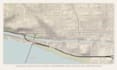


A custom map of the place that matters to you: your neighborhood, hometown or wedding venue. Send an address, venue name or coordinates, then choose your title and a second line such as a date.
What you get (digital files only)
Packages
Outside the US, or for a simple wedding street map with a heart or pin, I make a street map with water and parks instead.
Every map is built from real open data, OpenStreetMap and USGS elevation, credited small on the map.
Please read: nothing is printed or shipped, and no frame is included. A map is decor, not a survey, and not for navigation. Street data may miss recent changes. Files are for personal use.
I use AI-assisted tools to build each map and check every file myself.
GIS Mapmaker: Lidar Terrain, Hunting, Lake and Site Maps
Languages
Do you ship a printed map?
No. You get digital files only. Print them at a print shop or at home at actual size. The guide covers paper, size and framing. Colors vary between screens, printers and papers, so order a small test print before a large one.
Is the map accurate? Can I use it to navigate?
Street data comes from OpenStreetMap and may not show recent changes. The map is decor, not a survey, and not for navigation, property lines or legal use.
Which places can you map?
Neighborhood and Place maps use USGS elevation, so they are US only. Outside the US I make a street map with water and parks. For a venue, send the address or coordinates; the proof shows the spot so you can check it.
How are landmarks and names chosen?
Street, park and neighborhood names come from OpenStreetMap, so an area with few names there shows fewer. I pick landmarks near your spot (5, 10 or 15 by package), and you can name some to include. A label that cannot fit without overlap is dropped, and I tell you which.
Is my address kept private?
Your address is used only to place the map and is printed only if you type it into the title or second line. I look it up with the U.S. Census geocoder or OpenStreetMap's Nominatim and process it with AI-assisted tools (Claude, by Anthropic). Fiverr keeps the order messages.


