Browse categories
Explore
Fiverr Pro
English
$
USD


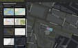
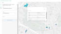
You will get a professional and fully interactive web map built with ArcGIS Online, designed to clearly visualize your data and support your decision-making.
As a GIS specialist with strong experience in cartography, spatial analysis, and data processing (ArcGIS, FME, Illustrator), I focus on delivering clean, efficient, and user-friendly web applications tailored to your needs.
Whether you need a simple interactive map or a more advanced web app with filters, popups, and multiple layers, I will help you turn your data into a powerful visual tool.
My goal is to provide high-quality work, clear communication, and fast delivery.
GIS Specialist, QGIS, ArcGIS, Cartography and Spatial Analysis
Languages
Do I need an ArcGIS Online account?
Yes, for publishing and hosting your web map. If you don’t have one, I can guide you.
What data formats do you accept?
Shapefile, GeoJSON, CSV, Excel, or any GIS format. I can also help you prepare your data.
Can you help if I don’t have data yet?
Yes, I can assist in finding or creating relevant datasets depending on your project.
Will the map be shareable?
Yes, your web map or app can be shared via link or embedded on your website.
Can you add custom features?
Yes, I can add filters, popups, layer controls, and other interactive elements depending on your needs.


