Browse categories
Explore
Fiverr Pro
English
$
USD

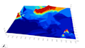
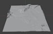
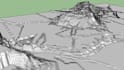


I create professional 3D terrain models for engineering, architectural, landscape, scientific, and GIS projects. I create Digital Elevation Models (DEM), Digital Terrain Models (DTM), Digital Surface Models (DSM), TIN models, Hillshade, contour lines, Slope Analysis, Aspect Analysis, and high-quality 3D terrain visualizations in Blender.
I work with contour lines, elevation points, topographic survey data, AutoCAD (DWG, DXF), GIS datasets (SHP, GeoPackage, GeoJSON), SRTM, Copernicus DEM, LiDAR, point clouds, orthophotos, orthomosaics, raster and scanned maps. When needed, I provide raster vectorization.
All models are created in QGIS and Blender with careful data preparation and quality control. The final result will be technically accurate, true to real-world conditions, and fully aligned with your project requirements. Deliverables can be provided in GIS vector formats, raster formats, as DEM/DTM/DSM, or in Blender and SketchUp formats. I can also add simple 3D buildings, trees, and vegetation with accurate placement.
GIS Specialist, Cartographer
Languages
What source data do you accept?
I work with contour lines, elevation points, topographic survey data, AutoCAD (DWG, DXF), SHP, GeoPackage, GeoJSON, raster maps, orthophotos, LiDAR, point clouds, SRTM, Copernicus DEM, and other GIS data formats.
Can you create a terrain model from a scanned map or image?
Yes. If needed, I can vectorize raster or scanned topographic maps before generating the terrain model. Please contact me first for large or complex projects.
Can you create realistic 3D visualizations?
Yes. I create technically accurate terrain models and can add simple 3D buildings, trees, and vegetation to produce clear and realistic visualizations.
Can you work with any location in the world?
Yes. I can create terrain models for any location worldwide using your data or publicly available elevation datasets.
What will I receive as the final result?
You will receive a technically accurate 3D terrain model created from your data and/or public elevation datasets, plus all editable working files. Deliverables are available in SHP, GeoPackage, GeoJSON, DXF, GeoTIFF, DEM, DTM, DSM, Blender, and SketchUp formats.
I'm not sure what I need. Can I contact you before ordering?
Yes, of course! Feel free to contact me if your project involves terrain, elevation data, or 2D/3D terrain visualization. Even if you're not sure what solution you need, I'll help you choose the best approach for your project.


