Browse categories
Explore
Fiverr Pro
English
$
USD

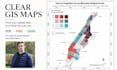
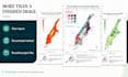

I will turn your spatial data into a GIS map that is clear, professionally structured and ready for a report, presentation, publication or website.
Each map is designed around its intended use, with a clear visual hierarchy and carefully considered cartographic choices.
Depending on the package, your delivery can include:
high-resolution PNG and print-ready PDF
title, legend, scale, labels and source information
basic checks of geometry, attributes and coordinate reference system
an editable QGIS project
a concise method and handover note
up to three visually coordinated maps
My approach is simple: spatial data creates value when the result can be understood, trusted and used after handover. I therefore keep the map, processing choices and file structure clear.
Please provide your data, geographic extent, intended use, preferred dimensions or format, and any visual requirements.
This Gig covers static GIS maps. Advanced spatial analysis, extensive data cleaning, data sourcing, remote-sensing analysis and interactive web maps require a custom offer.
Unsure whether your request fits a package? Please message me before ordering.
From raw spatial data to results you can understand and use
Languages
What data formats can I provide?
I can work with common spatial formats including Shapefile, GeoPackage, GeoJSON, KML/KMZ, GeoTIFF and CSV files containing coordinates. For Shapefiles, please include all associated files, especially .shp, .shx, .dbf and .prj. If you are unsure about your format, send me a sample before ordering.
Does my data need to be ready for mapping?
The Basic package requires prepared and usable data. Standard and Premium include basic checks and light preparation of geometry, attributes and coordinate reference systems. Extensive cleaning, repairing, restructuring or combining of datasets may require a custom offer.
What counts as one map?
One map is one finished layout covering one agreed geographic extent and communication purpose. A different extent, theme, variable or substantially different layout normally counts as an additional map.
Is the editable QGIS project included?
The editable QGIS project and organised project files are included in the Standard and Premium packages. Basic includes the finished PNG and PDF; the editable project can be added as an optional extra.
What is included in a revision?
A revision covers reasonable changes to styling, colours, labels or layout within the original brief. New datasets, geographic areas, analyses, map concepts or output formats are outside the original revision scope and may require an additional order.
Can you follow my organisation’s visual identity?
Yes. Please provide your logo, colour values, fonts, existing templates and any relevant brand guidelines. I will apply them where appropriate while maintaining map readability and clear visual hierarchy.
Does this Gig include spatial analysis or remote sensing?
This Gig focuses on static GIS map creation. Advanced spatial analysis, satellite-image processing, classification, machine learning, interactive web maps and dashboards are not included by default. Please contact me for a custom offer or a more suitable service.
Can you create maps for research or academic use?
Yes, I can help visualise spatial data for legitimate research, reports and publications. You remain responsible for the underlying research, interpretation, citations and compliance with your institution’s academic requirements.


