Browse categories
Explore
Fiverr Pro
English
$
USD

Hello there
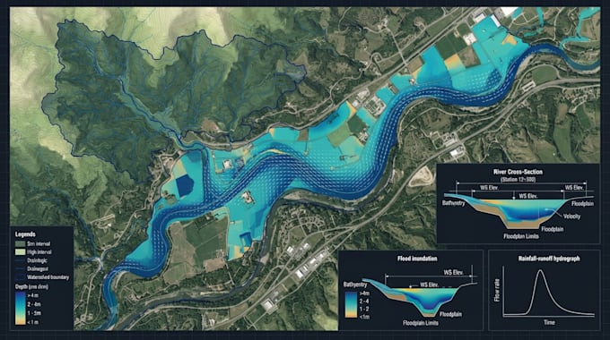
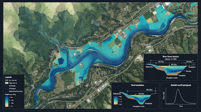
I will perform hydraulic and hydrologic modeling using HEC-RAS, HEC-HMS, ArcGIS, QGIS, and related GIS tools based on your project requirements and available data.
MY SERVICES INCLUDES
I can also integrate GIS, HEC-HMS, and HEC-RAS workflows where required, including preparing terrain and watershed data, developing hydrologic models, transferring relevant outputs into hydraulic models, running simulations, analyzing model results, and producing clear maps, figures, tables, and visualizations.
Please provide the following information when placing your order, where applicable:
Hydraulic Engineer
Languages
Can you work with HEC-RAS?
Yes. I can assist with HEC-RAS model setup, hydraulic simulations, geometry preparation, boundary conditions, result analysis, and visualization depending on the project scope and available data.
Can you work with HEC-HMS?
Yes. I can assist with watershed delineation, basin model development, rainfall-runoff modeling, parameter setup, simulation, hydrograph generation, and results analysis.
Do you work with GIS?
Yes. I can use GIS tools such as ArcGIS and QGIS for DEM processing, watershed delineation, terrain analysis, drainage analysis, flood mapping, and preparation of spatial datasets.
Can you create flood maps?
Yes, where the required terrain, hydraulic/hydrologic, and other necessary project data are available. The exact mapping workflow depends on the project and model configuration.
Can you work with my existing HEC-RAS model?
Yes. You can provide the existing model files and project data, and I can review, modify, troubleshoot, or analyze the model according to the requested scope.
Can you work with academic projects?
Yes. I can assist with modeling, GIS processing, visualization, calculations, and technical explanations. The work should be used in accordance with your institution's academic policies.