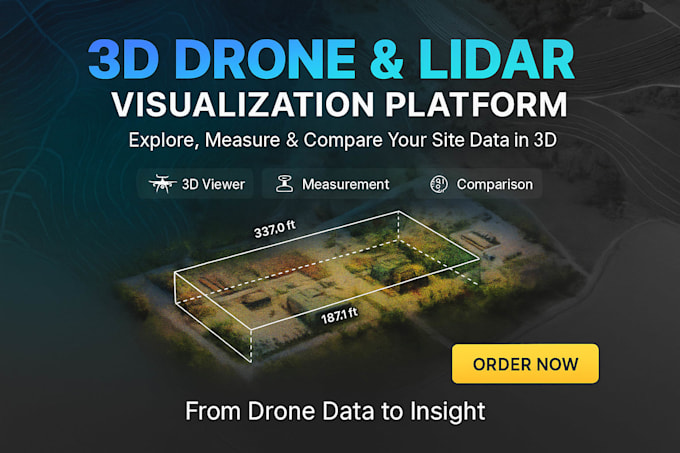
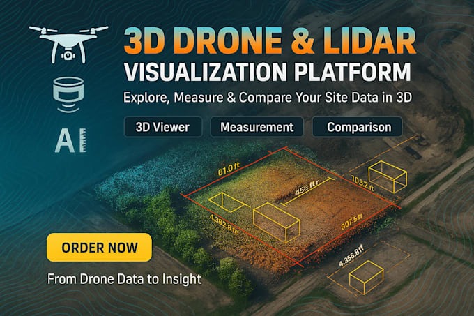
I will build a high-performance 3D Drone and LiDAR Visualization Platform that allows users to upload, explore, and analyze aerial or laser-scan data in the browser just like Track3D or DroneDeploy.
This platform transforms complex point clouds and orthomosaic data into an interactive web dashboard with built-in measurement, comparison, and reporting tools, ideal for construction, surveying, and inspection workflows.
️ Core Features
- Upload & visualize point clouds, orthomosaics, and terrain models
- Measure distance, area, and volume directly on the viewer
- Compare multi-date captures to visualize site changes
- 3D and 2D map modes with geospatial alignment
- Point-cloud color mapping (RGB, elevation, intensity)
- Annotation & markup tools for issue tracking
- PDF/CSV export of measurements and analytics
Technology Stack
- Frontend: React, CesiumJS, Three.js, Deck.gl, TailwindCSS
- Backend: FastAPI / Node.js + PostgreSQL + PostGIS
- Processing: Open3D, PDAL, CloudCompare automation, OpenDroneMap
- Hosting: AWS / GCP + S3 storage for large datasets