Browse categories
Explore
Fiverr Pro
English
$
USD


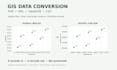
Need GIS data in a different format or coordinate system? I will convert one valid vector layer between Shapefile, KML, GeoJSON and CSV, with checks you can review.
BASIC PACKAGE
- One layer, up to 1,000 features and 20 MB
- One output format and one known target coordinate system
- Converted files, a simple PNG preview and a brief CRS/record-count report
- One revision within the original scope
CSV is for point coordinates or attribute exports. Shapefile delivery includes the required companion files. I preserve the original data and check output readability, feature counts and key IDs. Format limits, such as shortened Shapefile field names, will be noted.
Please provide the full source dataset, source CRS/EPSG, target format and CRS, and fields or IDs to retain. I will not guess an unknown CRS. Contact me first for unclear coordinates, invalid geometry or larger files.
Not included: field surveying, legal boundary certification, scanned-map tracing, CAD cleanup, spatial analysis or web GIS.
The gallery is a synthetic demonstration, not a client project.
GIS Mapping, CAD Data, Excel and Photo Editing
Languages
What if I do not know the coordinate system?
Please message me before ordering with a sample and any source information. I can assess it, but I will not guess the CRS or promise accurate conversion without enough evidence. The included map is a simple layer preview, not a survey or certified boundary map.
