I will build a custom Google Earth Engine analysis for remote sensing, LST, or hazard mapping
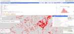
I work directly in the Earth Engine JavaScript/Python API to build custom remote sensing pipelines not template scripts.
What I can build for you:
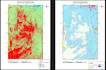
- Land Surface Temperature (LST) retrieval thermal band extraction and emissivity-corrected LST from Landsat 8/9 or MODIS, for any date or range you need (single-day snapshots or multi-temporal trend analysis)
- Land cover & change detection supervised classification (Random Forest, SVM, CART) using Sentinel-2 MSI or Landsat, with accuracy assessment (confusion matrix, kappa, F1)
- Hazard susceptibility mapping Random Forest-based susceptibility models (I've built landslide susceptibility maps for mountainous terrain using terrain derivatives slope, aspect, TWI combined with land cover and proximity layers as predictors)
- SAR + optical fusion Sentinel-1 (C-band SAR) alongside Sentinel-2 optical for cases where cloud cover or change detection needs an active sensor
- Vegetation & environmental monitoring NDVI/EVI/NDWI time series, seasonal trend extraction, anomaly detection.