I will do satellite image processing, digitization, spatial and raster analysis

R
rafia_va
R
rafia_va
Rafia

About this gig

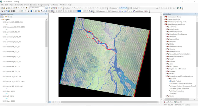
I am a Civil Engineer with more than 5 years of experience in GIS. I have work experience doing several research projects using ArcGIS. I will do satellite image processing, Google Earth Engine processing, Spatial Analysis and Raster Analysis.

I offer the following Services of GIS mappings including-

  1. Satellite Image processing
  2. Digitization
  3. Google Earth Engine
  4. Spatial Analysis
  5. Remote sensing Analysis
  6. Raster Analysis
  7. Interpolated Maps prepared with provided data
  8. Topographic Maps
  9. DEM, TIN, Contour Maps
  10. Watershed Analysis


If you're seeking a dedicated and detail-oriented person, I would be thrilled to collaborate with you. I am committed to finishing your project quickly and flawlessly. Feel free to contact me to discuss your project requirements. Thank you.

Get to know Rafia

Rafia

Civil Engineer

  • FromBangladesh
  • Member sinceMay 2023
  • Avg. response time2 hours
  • Last delivery1 year
  • Languages

    Bengali, English, French, German
Hello. This is Rafia. I have completed my BSc in Civil Engineering. I have worked in several research work and projects using ArcGIS as a GIS analyst. I offer the following Services of GIS mappings including Spatial Analysis, Raster Analysis, Remote sensing Analysis, Satellite Image processing, Interpolated Maps, Google Earth Engine, and Topographic Maps. If you're seeking a dedicated and detail-oriented person, I would be thrilled to collaborate with you. I am committed to finishing your project quickly and flawlessly. Feel free to contact me to discuss your project requirements. Thank you.