Browse categories
Explore
Fiverr Pro
English
$
USD

Level 2
Please message me before placing an order.
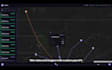
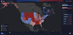
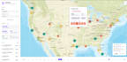
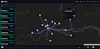
I create custom interactive web maps for websites, research, business, reports, presentations, education, and data visualization.
Map types include:
Interactive features can include:
I can work with geographic data, spreadsheets, CSV, GeoJSON, shapefiles, and other compatible datasets. I use HTML, CSS, JavaScript, Leaflet, Mapbox, OpenStreetMap, and Esri maps to create responsive, user-friendly interactive maps.
Whether you need a custom web map, interactive map visualization, GIS web map, or data-driven map, I can build it around your data and requirements.
Data Analysis, Data Visualization, Data Animation, GIS, Remote Sensing, Python
Level 2
Languages
What type of interactive maps can you create?
I can create location maps, marker maps, choropleth maps, heatmaps, thematic maps, polygon maps, boundary maps, and multi-layer interactive web maps.
Can you create a custom interactive map for my website?
Yes. I can create responsive interactive web maps that can be embedded into your website or web project.
What features can you add to an interactive map?
I can add custom markers, popups, tooltips, search, filters, layer switching, legends, zoom controls, data-driven styling, and other interactive map controls.
Which technologies do you use to create web maps?
I use HTML, CSS, JavaScript, Leaflet, Mapbox, OpenStreetMap, and Esri maps depending on the project requirements.
Can you create an interactive map from my existing GIS data?
Yes. I can work with compatible GIS and geographic datasets and convert them into an interactive web map.
Can the interactive map be customized to match my website?
Yes. Map colors, markers, popups, controls, legends, layouts, and other elements can be customized to match your website or project.
Can you create a map with multiple layers and filters?
Yes. I can create multi-layer interactive maps with layer controls, filters, search, custom popups, and data-driven visualization.