Browse categories
English
$
USD
Connect to your AI

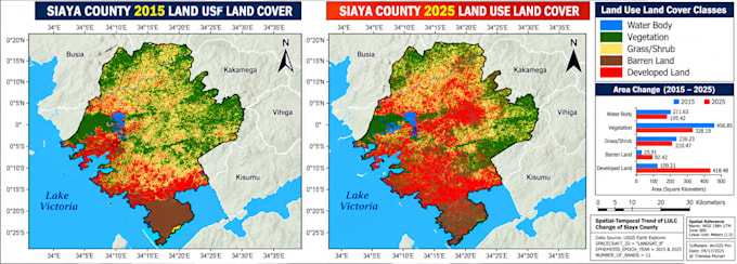
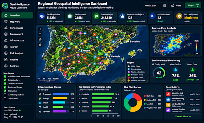
Need professional GIS mapping, geospatial data analysis, ArcGIS, QGIS, spatial analysis, or data visualization? I help businesses, researchers, students, engineers, planners, and organizations turn geographic data into accurate, meaningful maps and actionable insights.
My services include GIS mapping, geospatial data processing, thematic mapping, spatial analysis, location intelligence, map design, data visualization, site suitability analysis, buffer analysis, heat maps, and geographic information system (GIS) projects.
Whether you need GIS support for real estate, urban planning, civil engineering, agriculture, environmental studies, transportation, logistics, public health, or academic research, I can help deliver a solution tailored to your project.
I welcome clients from the USA, UK, Canada, Australia, Europe, Africa, and worldwide who need reliable geospatial solutions for professional, commercial, or research purposes.
WHY WORK WITH ME?
Send me your project requirements, dataset, location, and preferred output format.
WebGIS Developer
Languages
What GIS mapping and geospatial analysis services do you offer?
I offer GIS mapping, ArcGIS and QGIS projects, spatial analysis, geospatial data processing, thematic maps, heat maps, site suitability analysis, buffer analysis, and professional data visualization.
Which software and GIS tools do you use?
I can work with ArcGIS Pro, QGIS, and compatible geospatial tools depending on the project requirements, available data, and desired output.
Can you work with clients from any country?
Yes! I welcome clients worldwide, including the USA, UK, Canada, Australia, Europe, Africa, and other regions. I can work with location-specific datasets and coordinate systems provided for your project.
What files or information should I provide before ordering?
Please provide your project objective, study area or location, available datasets, preferred GIS software (if applicable), required analysis, and desired output format. If you are unsure, contact me for guidance.
Can you handle custom GIS projects and provide editable files?
Yes, I can discuss custom GIS mapping, spatial analysis, and geospatial visualization projects. Depending on the selected package, deliverables may include high-resolution maps, PDF or PNG exports, and editable ArcGIS or QGIS project files. Please message me first for complex requirements.