Browse categories
Explore
Fiverr Pro
English
$
USD


Need a professional land survey drawing that is accurate, clean, and ready for planning, permitting, or construction purposes?
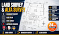
I specialize in drafting high-quality land survey, boundary survey, ALTA survey, plot plan, and site survey drawings using AutoCAD with precision and attention to detail.
Instead of dealing with unclear sketches, outdated files, or time-consuming revisions, you'll receive professionally drafted survey drawings that are organized, accurate, and ready for use.
Here is exactly what you get:
Every project is reviewed carefully to ensure accuracy, consistency, and client satisfaction before delivery.
Whether you need a plot plan, survey drawing, boundary survey, or complete land survey drafting service, I am here to help deliver professional results.
Send me your survey files and project details today, and let's get your drawing completed accurately and on time.
Please inform the freelancer of any preferences or concerns regarding the use of AI tools in the completion and/or delivery of your order.
EXPERT
Languages
Can you convert my PDF or scanned land survey into an AutoCAD drawing?
Yes. I can convert PDF, scanned, or image-based land survey files into accurate AutoCAD survey drawings with clean layers and professional formatting.
What files do I need to provide for a survey drawing project?
You can send a PDF, sketch, image, land survey, boundary survey, ALTA survey, or plot plan. I will review the files and confirm requirements before starting.
Do you provide source files with the final delivery?
Yes. Source files are included where selected. You can receive DWG, PDF, and other supported formats for future editing and use.
Can you revise or update an existing boundary survey or plot plan?
Absolutely. I can update, revise, or redraw existing boundary survey, plot plan, site survey, and land survey drawings based on your requirements.
How accurate are your AutoCAD survey drawings?
Accuracy is a top priority. I carefully draft survey drawings based on the information provided to ensure professional and reliable results.
Do you work on ALTA surveys and site survey drawings?
Yes. I draft ALTA surveys, site survey drawings, plot plans, and other survey-related documents for residential and commercial projects.
What if I am not sure which package to choose?
Simply send your files and project details. I will review your requirements and recommend the most suitable package before you order.
