Browse categories
Explore
Fiverr Pro
English
$
USD
Ingeniero Civil y dibujante CAD, Civil Engineer and CAD Drafter
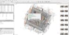
I work with LiDAR and photogrammetry point clouds for civil engineering, surveying and site design projects, handling everything from registration and noise cleanup to georeferencing, classification and terrain model generation. My background as a civil engineer means I understand what the data needs to look like once it reaches your design workflow, whether that's a DTM for grading, a classified cloud for BIM, or a clean export ready for CAD.
I process files in CloudCompare, Autodesk ReCap and Civil 3D, and export to the formats your project requires: LAS, LAZ, E57, RCP/RCS or DWG. Past projects have included multi-gigabyte scan datasets processed for architectural and engineering deliverables, along with terrain models used for earthwork volume calculations and sightline studies.
If your project involves a specific coordinate system, classification scheme or output format not listed in the packages, send me the details before ordering and I can scope it accordingly.