Browse categories
Explore
Fiverr Pro
English
$
USD

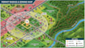
A project can look promising on paper until the surrounding parcels, zoning restrictions, and pending applications tell a different story.
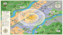
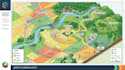
I create permit radius maps that turn scattered property and planning information into one clear visual reference. I can map the project location, surrounding parcel boundaries, zoning classifications, permit applications, development projects, and radius zones for property research, planning, site review, and development decisions.
Map Intelligence:
Decision Signals:
Research Edge:
Map Output:
Don't make a development decision from a single property record. Put the surrounding evidence on the map.
Send me the project location, required radius, and available property or permit information, and let's turn the surrounding area into a map you can actually use.
Please inform the freelancer of any preferences or concerns regarding the use of AI tools in the completion and/or delivery of your order.
Vector Map Illustrator
Languages
Can I use the map for a serious development or property decision?
The map is intended as a research and visual planning reference, not a substitute for an official survey, legal opinion, zoning determination, or government-issued permit record. I preserve the source context so you can verify important findings before acting.
What if the requested radius crosses several zoning or parcel boundaries?
That is exactly where a radius map becomes useful. The map can expose the different parcels, zoning classifications, applications, and projects intersecting the selected radius instead of treating the area as one block.
How do I know the map is actually centered on the correct project location?
The project address or coordinates are checked against the mapping data before the surrounding layers are assembled. This prevents a polished map from being built around the wrong location.
What if the parcel boundaries or zoning information are wrong?
I work from the available authoritative GIS, parcel, zoning, and planning sources for the requested area and clearly distinguish mapped information from assumptions. I do not quietly fill gaps with guesses.
Can you find permit or planning applications that do not appear on ordinary property maps?
Yes. Where public application or permit records are available, I can incorporate relevant records into the project map and connect them spatially to the surrounding parcels and radius.


