Browse categories
Explore
Fiverr Pro
English
$
USD

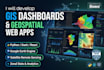
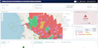
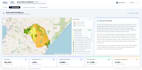

Are you looking for a modern, responsive React dashboard with interactive Web GIS maps and spatial data visualization? I build fast, custom web applications that turn complex geospatial data into intuitive visual insights.
What I Offer:
- Custom React Web Apps: Clean, modular frontend using React, Next.js, and modern CSS (Tailwind/MUI).
- Interactive Web GIS: Seamless integration of Mapbox GL JS, Leaflet, or OpenLayers with custom popups, tooltips, and markers.
- Spatial Layers & Analytics: Multi-layer toggles, choropleth maps, point clustering, heatmaps, and GeoJSON overlays.
- Data Visualization: Analytical charts and KPI metric cards using Recharts or Chart.js.
- Data Connectivity: Support for GeoJSON, Shapefiles, CSV, JSON, and live REST API / database integration.
Why Work With Me?
- Production-ready, maintainable, and well-documented source code.
- Fully responsive design across desktop, tablet, and mobile.
- Fast communication and on-time delivery.
Please message me before placing an order so we can review your dataset and technical requirements!
Website Developer
Languages
Which mapping libraries do you work with?
I primarily build with Mapbox GL JS, Leaflet, and OpenLayers inside React, depending on your project requirements and preferred basemaps.
What spatial and dataset formats do you support?
I can connect and visualize data from GeoJSON, Shapefiles, KML, CSV, JSON, or live endpoints from REST APIs and databases like PostGIS or Supabase.
Do you provide the full source code?
Yes, all packages include clean, modular, and fully documented React source code with setup instructions.
Can you help deploy the dashboard live?
Yes! I can configure and deploy your application directly to Vercel, Netlify, or your preferred cloud hosting environment via Gig Extras.
Can you integrate custom filters and search bars?
Yes, I can implement dynamic layer toggles, geographic search (geocoding), date-range filters, and spatial buffer selections.


