Browse categories
Explore
Fiverr Pro
English
$
USD

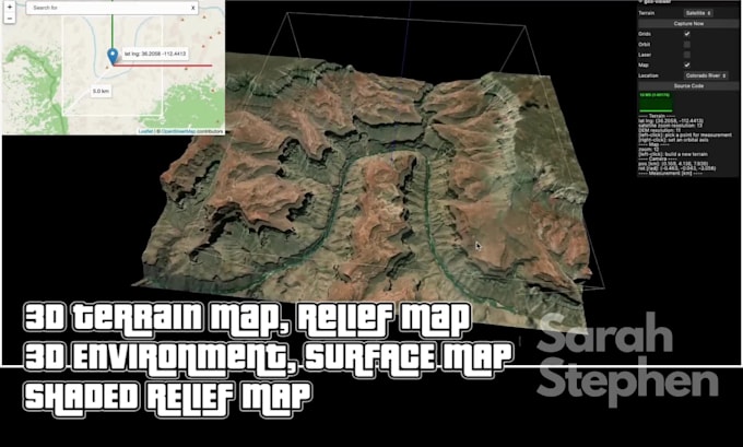
Looking for a professional to design a high-quality 3D terrain map or 3D landscape for your project? I specialize in creating realistic relief maps, surface maps, and detailed topographic maps that are perfect for presentations, research, planning, and visualization.
Here's what I can deliver for you:
Why choose me:
Freebie I offer:
Every client who chooses me for their project will receive a free high-resolution shaded relief map preview of their terrain before final delivery.
If you want a map that looks professional, accurate, and engaging, I'm ready to bring your vision to life.
Please inform the freelancer of any preferences or concerns regarding the use of AI tools in the completion and/or delivery of your order.
Languages
What do you need from me to make a 3D terrain or relief map of my land?
I’ll need the area of interest, any elevation data you have (DEM, LiDAR, satellite, etc.), the preferred scale (how detailed you want it), the format you prefer for the final output (OBJ, FBX, PNG, TIFF, etc.), and any style preferences like shaded relief, realistic, or topographic lines.
How accurate will the topographic or surface map be?
I work with trusted elevation sources such as DEM or satellite data, processed in GIS tools like ArcMap. The accuracy mostly depends on the quality of the data you provide. If you have high-resolution DEM files, the relief and shading will be much more precise.
Can you make a 3D landscape or environment for any location?
Yes, I can create maps for almost any location worldwide as long as elevation data is available. If the area is remote and the data is limited, I’ll let you know the level of detail possible and suggest alternatives.
What deliverables or formats will I get?
I can provide mesh files like OBJ, FBX, or STL, high-resolution images like PNG, JPEG, or TIFF, and GIS formats such as GeoTIFF or SHP. You can also request different map types like shaded relief maps, topographic maps, or surface maps.
How long will it take and how many revisions do I get?
A small to medium-sized project usually takes a few days if data is ready. Larger or more detailed terrains take longer. I normally include 2–3 revisions so you can ask for changes to shading, contour intervals, or visual style.
What is included in the cost and what might increase it?
The standard package includes terrain modeling, relief shading, topographic detailing, and the final files in your requested format, along with a free preview. Costs may go up for very large areas, ultra-high resolution terrain, additional 3D environment elements like water or buildings.