Browse categories
Explore
Fiverr Pro
English
$
USD


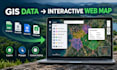

Need to turn your GIS or survey data into a clear, interactive web map?
I will convert your GIS or survey data into a browser-based interactive map using Leaflet. I can work with GeoJSON, Shapefile, KML, CSV, and coordinate-based datasets.
What I can provide:
This service is suitable for survey data, property and infrastructure mapping, research projects, environmental data, business locations, planning, tourism, and other location-based projects.
Why choose me?
Im a Geomatics professional with around 5 years of practical experience in surveying, GIS, remote sensing, and geospatial data processing. I focus on accurate data handling, clean map presentation, practical functionality, and clear communication.
Please message me before ordering if you have large datasets, complex requirements, custom filters, search functions, database/API integration, or other advanced features.
WebGIS and Interactive Mapping Specialist
Languages
What GIS or survey data can you provide?
I can work with GeoJSON, Shapefile, KML, CSV, and coordinate-based datasets. If you have another format, please contact me before ordering.
Can you convert my existing survey data into a web map?
Yes. I can process your existing survey or GIS data and convert it into an interactive browser-based web map while maintaining the structure and attributes of your data.
What features can you include in the web map?
Depending on your package, I can include interactive points, lines and polygons, feature popups, multiple layers, layer controls, custom styling, basemaps, and basic map controls.
Can you create a web map from a Shapefile or GeoJSON?
Yes. Shapefile and GeoJSON are supported formats. I can prepare the data and visualize the features in an interactive web map.
Will the web map work on mobile devices?
Yes. Web maps can be optimized for browser viewing on both desktop and mobile devices, depending on the project requirements.
Can you handle large datasets or custom web map features?
Yes, but larger datasets and advanced features such as complex filters, search, database integration, APIs, or custom functionality may require additional work. Please message me before ordering so I can review your requirements.


