Browse categories
Explore
Fiverr Pro
English
$
USD

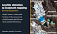
Looking for alteration zones and structures before you spend money in the field? I map them from satellite imagery, the way an exploration geologist would.
What I do:
- Clay, sericite, iron oxide and carbonate alteration from ASTER, Sentinel-2 and Landsat (band ratios, Crosta PCA)
- Clouds, water and vegetation masked before any ratio; thresholds from your area's own statistics, stated on the map
- Every anomaly checked against imagery and land use: mines, roads, fields and crusts are flagged, not sold as targets
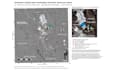
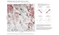
- Lineaments from DEM with directional analysis (rose diagrams)
- Zones for field checking, ranked with written reasons
You get maps (PDF, PNG), GeoTIFF rasters, shapefiles or GeoPackage, a KMZ for Google Earth and a short methods note.
Any commodity: gold, copper, lithium, base metals, industrial minerals. Send your area as KML, shapefile or coordinates.
Remote sensing shows where to look, not what is there. Every zone is a proposal to check in the field.
Exploration Geologist, AI Driven Mineral Prospectivity and GIS Specialist
Languages
What do I need to send?
Your area of interest (KML, KMZ, shapefile or corner coordinates) and the commodity you are looking for. A geological map or previous data helps but is not required.
Can you tell me where the gold is?
No one can from satellite data alone. I show where alteration and structures suggest the ground is worth checking, and I flag false positives. Field mapping and sampling confirm or reject each zone.
Is my area too big?
Message me with the size. Larger areas are possible with a custom offer.


