Browse categories
Explore
Fiverr Pro
English
$
USD
GIS and Spatial Analysis Specialist, MSc Spatial Engineering
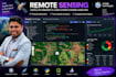
I analyze satellite imagery in Google Earth Engine to track land cover change, vegetation health, water bodies, and urban growth over time.
What you get: land cover and land use change detection across multiple years, NDVI, NDWI, and vegetation or water index analysis, cloud-free composite imagery for your area of interest, and exported GeoTIFFs, charts, and a summary write-up.
Why this is different: most GIS freelancers stop at desktop software. I combine that with Google Earth Engine (part of my MSc coursework at ITC-University of Twente) and 6 years of on-the-ground environmental fieldwork, so the analysis is grounded in how the data is actually used for EIA/ESIA and climate work.
Pair with my GIS Mapping gig for a full spatial report, or see my Urban Heat Island gig for temperature-specific analysis.
Tell me your area and time range and I'll scope the exact analysis before we start.

Technology:
Jupyter Notebook
•
arcgis
•
Pandas
Expertise:
Statistics
•
Time series analysis
Programming language:
Python