Browse categories
Explore
Fiverr Pro
English
$
USD
GIS and Geology professional
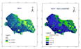
I'm a Geologist and GIS Analyst skilled in QGIS and Remote Sensing. I'll help you transform your spatial data into meaningful maps and visuals for reports, research, or presentations.
Services I Offer:
Thematic and Geological Map Creation
Land Use / Land Cover (LULC) Analysis
Groundwater / Drainage / Watershed Mapping
Environmental or Forest Mapping
Map Layout and Data Visualization for Reports
Landslide Susceptibility Zonation, Flood Mapping
Why Choose Me?
Clean, publication-ready outputs
Fast delivery and unlimited revisions
Clear legends, scale bars, and north arrows
00% accuracy using trusted GIS datasets
Deliverables:
High-resolution map images (JPEG/PNG/PDF)
Editable project files (QGIS, shapefiles, etc., on request)


Topic:
Landscape design
Please inform the freelancer of any preferences or concerns regarding the use of AI tools in the completion and/or delivery of your order.


